


Sunday
Aug232015
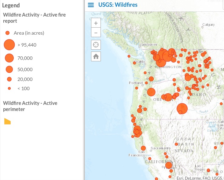
Interactive map of wildfires in the U.S.
Yikes.
LINK (via: The Seattle Times)
Things are particularly rough in eastern Washington.
#TwispRiver is flowing red because of retardant drop in river. See http://t.co/NGBKzNbrim for more #TwispRiverFire pic.twitter.com/8Jp1M6Zgpw
— Joshua Trujillo (@joshtrujillo) August 21, 2015
tagged  forest fires, mmaps, wildfires in Climate
Climate 