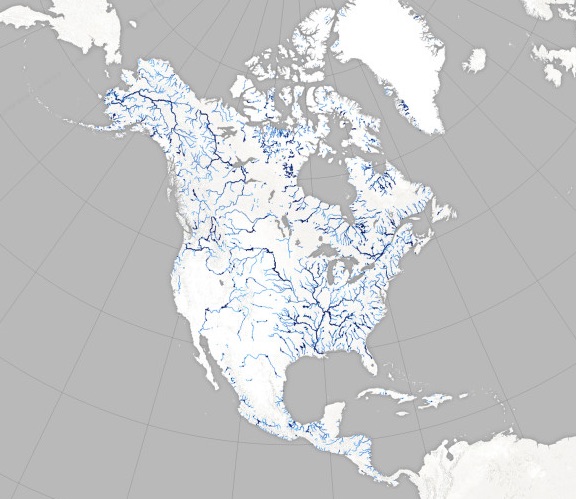
More of North America’s land is covered by rivers than we thought, according to a new map. Scientists came up with a way to use satellite images to estimate the width of rivers and found that previous methods tended to underestimate how wide they are. The discovery could have implications for studies of flood risk as well as climate change impacts.
LINK (via: Wired)